- Home
- About Us
- Products
- Services
- 3D Scanning Services
- 3D Inspection Service
- Reverse Engineering Services
- Lieca 3D Laser Tracker Services
- 3D Plant Scanning
- CNC Machine Laser Calibration Service
- Engineering Analysis And Simulation Services
- 3D Printing Service
- CAM Milling Services
- CAM Turning Services
- Software Sales
- Education / Training
- Statue Of 3D Scanning Services
- RTC 360 Plant & Refinery Scanning Services
- CNC Machine Laser Calibration & Operating Service
- Best 3D Printing Service
- Updates
- Gallery
- Contact Us
Drone Scanning Service In Dhanbad
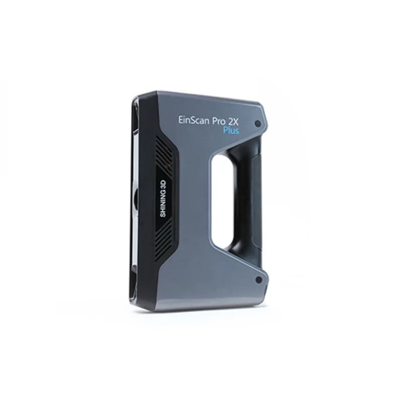
Details of EinScan-Pro 2X Plus
Accuracy and trust guide our drone scanning service in Dhanbad, leaving no room for errors when meeting client needs. We handle aerial data collection with care and thoroughness.
Drone scanning blends digital engineering into physical site surveys, capturing detailed topography and structures quickly. This technology cuts down on manual checks and speeds up project timelines without losing quality or detail.
We help teams work better by providing precise maps and 3D models from drone scans that support planning, monitoring, and maintenance. This kind of data tightens workflows and reduces costly mistakes often found in traditional methods.
Contact us to arrange drone scanning for your site in Dhanbad. Our experts can walk you through the process and tailor the service to fit your project goals effectively.
Offered Product

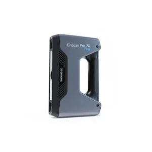
EinScan-Pro 2X Plus
All In One Versatility : Offer Both Portability And High-accuracy Because Of Its Four Versatile Operating Modes. Multi-applications : Create An Accurate, 3D Printable Model Of Existing Physical Objects—whether It Be An Industrial Part, A Sculpture, A Delicate Family Heirloom, An Antique Toy, A Hard-to-find Replacement Part For Your Tool Kit Or Even A Scan Of Your Own Body Parts.High Speed : In The Handheld Scan Mode, The Scan Speed Is 10 Fps (frames Per Second) And In The Automatic A... Read more3d Terrestrial Scanning Service In Bengaluru
3D Terrestrial Scanning Service In Bengaluru Starts With Careful Planning To Match Your Needs. We Focus On Clear Data Capture From Large Sites And Complex Structures. The Process Avoids Delays By Using Modern Scanners That Gather Detailed Measurements Fast, So You Get Reliable 3D Models For Your Projects.Handling Big Industrial Areas Or Infrastructure Demands Strategic Adjustments. We Adjust Scanning Angles And Set Up Multiple Stations For Full Coverage. This Agility Lets Us Work Around Site Lim Continue
3d Terrestrial Scanning Service In Agra
We Hold A Strong Focus On Accurate 3D Terrestrial Scanning Services In Agra. Our Work Values Sharpness And Timeliness, Making Us A Reliable Choice For Engineering Projects Needing Exact Digital Capture Of Physical Environments.Understanding Engineering Data Over Its LifecycleHandling Data Through Its Full Lifecycle Is Tough But Crucial. We Collect Precise Scan Data Using Advanced Equipment, Then Process It With Software That Keeps Details Intact Over Time. This Allows Easier Updates And Reuse Of Continue
Drone Scanning Service In Kota
Providing Drone Scanning Service In Kota, We Focus On Clear Data Capture And Precise Survey Results. We Aim To Help Clients Get Quick Site Surveys With Good Detail. Drone Scanning Cuts Time And Risk For Inspections In Tough Places.Planning Drone Scans Starts With Understanding The Terrain And Obstacles. We Map Out Flight Paths Before Operations To Avoid Surprises. Safety Checks Come First; Drones Must Fly Within Set Rules, Especially Near Urban Or Industrial Zones. Weather Can Halt Flights—win Continue