- Home
- About Us
- Products
- Services
- 3D Scanning Services
- 3D Inspection Service
- Reverse Engineering Services
- Lieca 3D Laser Tracker Services
- 3D Plant Scanning
- CNC Machine Laser Calibration Service
- Engineering Analysis And Simulation Services
- 3D Printing Service
- CAM Milling Services
- CAM Turning Services
- Software Sales
- Education / Training
- Statue Of 3D Scanning Services
- RTC 360 Plant & Refinery Scanning Services
- CNC Machine Laser Calibration & Operating Service
- Best 3D Printing Service
- Updates
- Gallery
- Contact Us
3d Terrestrial Scanning Service In Kolkata
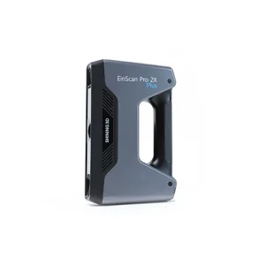

Details of EinScan-Pro 2X Plus
Choosing us for your 3D terrestrial scanning needs in Kolkata means working with a partner who values ethics and openness above all else. We focus on accuracy and timely delivery, making sure projects move forward without delays. Our service includes detailed 3D scans that capture large sites or objects with high precision.
Managing complex infrastructure calls for smart control. Our approach to lifecycle management uses advanced scanning methods to create clear records of current conditions. This lets clients plan repairs or upgrades based on exact data rather than guesses, cutting downtime and waste. The scans cover everything from pipelines to building exteriors, delivering rich data sets that fit into existing workflows.
Investing in reliable technology today avoids bigger costs later. Our scanning tools not only gather surface data but also work well under tough site conditions like dust or low light, reducing need for repeat visits. That means quicker results and less disruption on site—critical for industrial clients balancing many tasks at once. Plus, the data supports long-term planning, helping businesses stretch budgets while keeping assets safe.
See why companies trust us: we respond fast when asked, tailor solutions to each project's scale, and back our work with skilled technicians who know the field's challenges firsthand. The feedback often points to our practical approach rather than flashy promises—we deliver what’s needed without overselling capabilities.
Offered Product

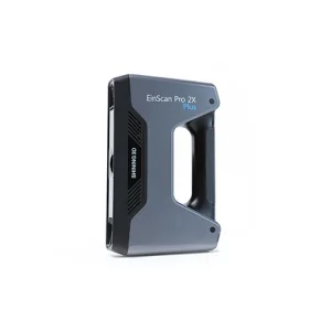
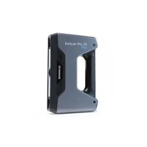
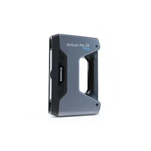
EinScan-Pro 2X Plus
All In One Versatility : Offer Both Portability And High-accuracy Because Of Its Four Versatile Operating Modes. Multi-applications : Create An Accurate, 3D Printable Model Of Existing Physical Objects—whether It Be An Industrial Part, A Sculpture, A Delicate Family Heirloom, An Antique Toy, A Hard-to-find Replacement Part For Your Tool Kit Or Even A Scan Of Your Own Body Parts.High Speed : In The Handheld Scan Mode, The Scan Speed Is 10 Fps (frames Per Second) And In The Automatic A... Read moreDrone Scanning Service In Allahabad
When You Choose Us For Drone Scanning Service In Allahabad, Expect Clear Communication And Steady Progress Throughout. Our Approach To Aerial Data Capture Focuses On Accuracy And Timely Delivery, Cutting Down Field Time Without Losing Quality. The Process Starts With Site Evaluation To Pick The Best Flight Paths, Then Moves Through Careful Scanning Using Drones Equipped With High-resolution Sensors.Then There's The Matter Of Data Security. Handling Sensitive Aerial Data Needs Strict Controls To Continue
3d Terrestrial Scanning Service In Indore
Delivering Clear-cut Strategies For 3d Terrestrial Scanning Service In Indore Takes More Than Just Good Equipment. We Handle Every Step From Setup To Data Capture With Focus On Ease And Efficiency. The Goal Is To Collect Precise Spatial Data That Supports Engineering, Construction, And Infrastructure Projects Without Delays.Data Accuracy Can Make Or Break Project Timelines. Our Approach Includes Careful Planning Of Scan Locations And Paths, Ensuring Minimal Rework. Using Advanced Laser Scanners Continue
3d Terrestrial Scanning Service In Gwalior
Each Task Under The 3D Terrestrial Scanning Service In Gwalior Gets Careful Attention Based On Client Needs, Making The Work Straightforward And Clear. We Focus On Exact Data Capture Using High-grade Laser Scanners To Map Large Outdoor Areas Accurately. The Goal Is To Help Clients Get Usable, Detailed Scans Without Fuss.Advanced Documentation WorkflowThe Scanning Process Includes Multiple Steps That Cover Site Prep, Scan Planning, Data Acquisition, And Post-processing. Using Advanced Software To Continue