- Home
- About Us
- Products
- Services
- 3D Scanning Services
- 3D Inspection Service
- Reverse Engineering Services
- Lieca 3D Laser Tracker Services
- 3D Plant Scanning
- CNC Machine Laser Calibration Service
- Engineering Analysis And Simulation Services
- 3D Printing Service
- CAM Milling Services
- CAM Turning Services
- Software Sales
- Education / Training
- Statue Of 3D Scanning Services
- RTC 360 Plant & Refinery Scanning Services
- CNC Machine Laser Calibration & Operating Service
- Best 3D Printing Service
- Updates
- Gallery
- Contact Us
3d Terrestrial Scanning Service In Coimbatore


Details of EinScan-Pro 2X Plus
Offering reliable 3D terrestrial scanning service in Coimbatore calls for sharp execution and a clear hold on quality throughout the process. We handle everything from initial site setup to data delivery with care, making sure each step sticks to set standards.
The scanning journey starts with understanding client needs on location, then setting up the scanner properly for the environment. After capturing the raw point clouds, we clean and register data to form usable models that fit client demands, whether it's for construction monitoring or plant documentation. This workflow keeps the whole process tight and traceable.
How Our Service Works
- Site Survey
- Initial walk-through and assessment of area conditions to plan scanning points.
- Data Capture
- Use of high-precision terrestrial scanners to collect detailed spatial data from multiple angles.
- Data Processing
- Cleaning, aligning, and stitching scanned data into coherent 3D models ready for analysis or BIM integration.
- Delivery
- Providing clients with accurate 3D outputs in formats suitable for their use cases like CAD software or VR applications.
The tools we employ include laser scanners capable of sub-millimeter accuracy along with software that supports large datasets without lag. It lets us maintain quality even at big industrial sites or complex infrastructure projects (like the highway junction near Peelamedu). These details matter when measurements guide critical decisions.
Measuring workforce efficiency involves checking how fast field teams set up scanners under varying site constraints plus how quickly back-end experts turn point clouds into actionable models. Tracking these metrics helps improve turnaround times and reduce errors that might creep in due to tough outdoor conditions or technical glitches during registration processes.
This approach aims not just at delivering one-off scans but building long-term relationships by helping clients upgrade their digital records progressively over time. We work alongside them as projects grow or new challenges surface, adapting methods as needed. A growth plan includes training local staff on operating equipment safely plus offering updates on latest scanning tech periodically. It's about staying relevant rather than just completing tasks once-off.
Offered Product

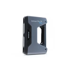
EinScan-Pro 2X Plus
All In One Versatility : Offer Both Portability And High-accuracy Because Of Its Four Versatile Operating Modes. Multi-applications : Create An Accurate, 3D Printable Model Of Existing Physical Objects—whether It Be An Industrial Part, A Sculpture, A Delicate Family Heirloom, An Antique Toy, A Hard-to-find Replacement Part For Your Tool Kit Or Even A Scan Of Your Own Body Parts.High Speed : In The Handheld Scan Mode, The Scan Speed Is 10 Fps (frames Per Second) And In The Automatic A... Read more3d Terrestrial Scanning Service In Indore

Delivering Clear-cut Strategies For 3d Terrestrial Scanning Service In Indore Takes More Than Just Good Equipment. We Handle Every Step From Setup To Data Capture With Focus On Ease And Efficiency. The Goal Is To Collect Precise Spatial Data That Supports Engineering, Construction, And Infrastructure Projects Without Delays.Data Accuracy Can Make Or Break Project Timelines. Our Approach Includes Careful Planning Of Scan Locations And Paths, Ensuring Minimal Rework. Using Advanced Laser Scanners Continue
3d Terrestrial Scanning Service In Greater Noida
Responsibility For Delivering High-quality 3D Terrestrial Scanning Service In Greater Noida Rests On Practical Experience Combined With An Understanding Of Local Business Conditions. We Handle Complex Spatial Data Collection Using Ground-based Laser Scanners To Capture Precise Geometry And Surface Details For Various Industrial And Infrastructure Projects. The Process Demands Careful Planning To Cover All Critical Areas While Managing Time And Resource Constraints Common In Urban Environments.Ou Continue
3d Terrestrial Scanning Service In Surat

Providing 3D Terrestrial Scanning Service In Surat Involves More Than Just Delivery; It Means Fostering Ongoing Collaboration That Adapts To Client Needs. We Focus On The Entire Digital Engineering Lifecycle, Capturing Real-world Data Accurately And Feeding It Into Design And Analysis Workflows. This Approach Helps Manage Project Changes Better And Reduces Rework Later.The Backbone Of Good Scanning Lies In Strong Digital Infrastructure. Our Systems Handle Large Point Clouds Swiftly, Making Sure Continue