- Home
- About Us
- Products
- Services
- 3D Scanning Services
- 3D Inspection Service
- Reverse Engineering Services
- Lieca 3D Laser Tracker Services
- 3D Plant Scanning
- CNC Machine Laser Calibration Service
- Engineering Analysis And Simulation Services
- 3D Printing Service
- CAM Milling Services
- CAM Turning Services
- Software Sales
- Education / Training
- Statue Of 3D Scanning Services
- RTC 360 Plant & Refinery Scanning Services
- CNC Machine Laser Calibration & Operating Service
- Best 3D Printing Service
- Updates
- Gallery
- Contact Us
Drone Scanning Service In Vadodara


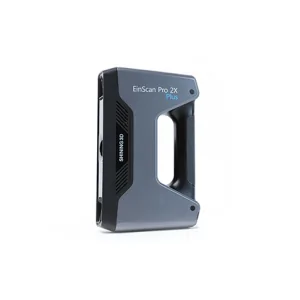
Details of EinScan-Pro 2X Plus
Missed deadlines or subpar work from other providers of drone scanning service in Vadodara can cause setbacks; our focus is on reliability and accuracy at every step. We handle projects with timely data capture and precise processing to avoid delays. Drone scanning brings speed but also requires skilled operation to get consistent results.
Drone scanning works best when site conditions are documented properly before flights. Clear weather, proper ground control points, and detailed flight plans affect data quality directly. Without this preparation, scan outputs vary widely, causing rework or poor decision-making later. It’s critical we record the environment and constraints upfront to guide the mission safely and efficiently.
Operational efficiency matters beyond just flying drones fast. Data transfer protocols, software compatibility, and skilled analysts reduce turnaround time for usable deliverables. Keeping communication tight between field teams and office speeds up problem resolution during large projects. The right tools combined with trained staff help minimize downtime in tough urban or industrial areas where airspace rules are strict.
Aligning for long-term organizational excellence means building trust through repeatable processes rather than quick fixes. We invest in proven drones, training programs, and post-processing methods that meet industrial standards consistently. Clients see us as a dependable partner because we anticipate challenges like battery limits or sensor calibration needs well ahead of time (something overlooked often). This commitment supports ongoing success rather than one-off contracts.
Offered Product

EinScan-Pro 2X Plus
All In One Versatility : Offer Both Portability And High-accuracy Because Of Its Four Versatile Operating Modes. Multi-applications : Create An Accurate, 3D Printable Model Of Existing Physical Objects—whether It Be An Industrial Part, A Sculpture, A Delicate Family Heirloom, An Antique Toy, A Hard-to-find Replacement Part For Your Tool Kit Or Even A Scan Of Your Own Body Parts.High Speed : In The Handheld Scan Mode, The Scan Speed Is 10 Fps (frames Per Second) And In The Automatic A... Read more3d Terrestrial Scanning Service In Surat

Providing 3D Terrestrial Scanning Service In Surat Involves More Than Just Delivery; It Means Fostering Ongoing Collaboration That Adapts To Client Needs. We Focus On The Entire Digital Engineering Lifecycle, Capturing Real-world Data Accurately And Feeding It Into Design And Analysis Workflows. This Approach Helps Manage Project Changes Better And Reduces Rework Later.The Backbone Of Good Scanning Lies In Strong Digital Infrastructure. Our Systems Handle Large Point Clouds Swiftly, Making Sure Continue
3d Terrestrial Scanning Service In Muzaffarpur

We Are The Reliable 3D Terrestrial Scanning Service Provider In Muzaffarpur, Committed To Delivering Quality Results That Meet Your Business Needs Every Time With Clear Communication And Timely Completion. Our Approach Focuses On Capturing Accurate Spatial Data Using Advanced Scanning Technology Suited For Complex Industrial And Infrastructure Projects.Scanning Large Sites Often Faces Issues Like Environmental Interference And Access Restrictions. We Manage These By Using Portable Laser Scanners Continue
Drone Scanning Service In Aurangabad
We Take Responsibility As A Dedicated Provider Of Drone Scanning Services In Aurangabad, Ensuring Every Step Aligns With Your Business Goals Through Tested Procedures. Using Drones For Scanning Helps Us Reach Difficult Spots Fast And Gather Data That Traditional Tools Miss. We Manage The Entire Process Carefully To Give You Clear Results That Suit Your Project Needs.Digital Spatial Lifecycle Integration Means We Don't Just Scan; We Link Data From Start To End. Capturing The Site With Drones Is J Continue