- Home
- About Us
- Products
- Services
- 3D Scanning Services
- 3D Inspection Service
- Reverse Engineering Services
- Lieca 3D Laser Tracker Services
- 3D Plant Scanning
- CNC Machine Laser Calibration Service
- Engineering Analysis And Simulation Services
- 3D Printing Service
- CAM Milling Services
- CAM Turning Services
- Software Sales
- Education / Training
- Statue Of 3D Scanning Services
- RTC 360 Plant & Refinery Scanning Services
- CNC Machine Laser Calibration & Operating Service
- Best 3D Printing Service
- Updates
- Gallery
- Contact Us
Einscan PRO2X Plus 3D Scanner Suppliers In Rajkot


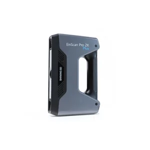
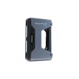
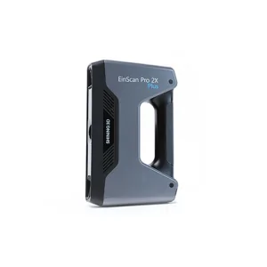
Details of EinScan-Pro 2X Plus
We are a prominent company by provides a premium quality range of Einscan PRO2X Plus 3D Scanner Resellers. This system is ideal for scanning small-to-medium-sized objects, and it does so at an incredibly high speed without sacrificing quality. The EinScan Pro 2X Plus offers four different 3D scanning modes: Handheld Rapid Scan Mode, Handheld HD Scan, and Fixed Scan Mode (both with or without a turntable). It also supports a range of alignment modes, including feature alignment, markers alignment, turntable coded targets alignment, and manual alignment.
This is available in various models, dimensions, and working functionality. our patrons can afford this Einscan PRO2X Plus 3D Scanner Reseller at budget-friendly value.
#Einscan PRO2X Plus 3D Scanner Reseller
Offered Product

EinScan-Pro 2X Plus
All In One Versatility : Offer Both Portability And High-accuracy Because Of Its Four Versatile Operating Modes. Multi-applications : Create An Accurate, 3D Printable Model Of Existing Physical Objects—whether It Be An Industrial Part, A Sculpture, A Delicate Family Heirloom, An Antique Toy, A Hard-to-find Replacement Part For Your Tool Kit Or Even A Scan Of Your Own Body Parts.High Speed : In The Handheld Scan Mode, The Scan Speed Is 10 Fps (frames Per Second) And In The Automatic A... Read moreDrone Scanning Service In Vadodara
Missed Deadlines Or Subpar Work From Other Providers Of Drone Scanning Service In Vadodara Can Cause Setbacks; Our Focus Is On Reliability And Accuracy At Every Step. We Handle Projects With Timely Data Capture And Precise Processing To Avoid Delays. Drone Scanning Brings Speed But Also Requires Skilled Operation To Get Consistent Results.Drone Scanning Works Best When Site Conditions Are Documented Properly Before Flights. Clear Weather, Proper Ground Control Points, And Detailed Flight Plans A Continue
3d Terrestrial Scanning Service In Indore
Delivering Clear-cut Strategies For 3d Terrestrial Scanning Service In Indore Takes More Than Just Good Equipment. We Handle Every Step From Setup To Data Capture With Focus On Ease And Efficiency. The Goal Is To Collect Precise Spatial Data That Supports Engineering, Construction, And Infrastructure Projects Without Delays.Data Accuracy Can Make Or Break Project Timelines. Our Approach Includes Careful Planning Of Scan Locations And Paths, Ensuring Minimal Rework. Using Advanced Laser Scanners Continue
Drone Scanning Services In Meerut
By Keeping Track Of The Latest Market Developments, We Offer High-precision Drone Scanning Services In Meerut. These Services Are Systematically Performed Using High-resolution Drones And Advanced Aerial Data Processing Software To Capture Detailed Site Information. Ideal For Construction, Mining, And Land Surveys, Drone Scanning Enables Fast Data Collection, Improved Safety, And Cost Efficiency. All Captured Data Is Thoroughly Analyzed To Deliver Accurate Maps, Point Clouds, And Actionable Insi Continue